With a camera system capable of achieving on-the-ground pixel sizes as small as 0.5cm, we can undertake rapid surveys for infrastructure projects, whether to inform feasibility studies for cables, pipelines or transport infrastructure or to monitor condition for operational schemes. We have applied our services across a range of topics such as nature conservation (including deer and habitat) surveys, road, rail, water and utility sectors.
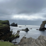
We access hard-to-reach areas and survey large areas rapidly and safely, saving significant time and cost on traditional methods of terrestrial survey. Our high-resolution system gives us the ability to recognise objects less than 1cm in size and we design each survey programme to meet our Clients’ specific needs. This gives us an unrivalled capability to undertake characterisation, Phase I habitat, or resource management surveys (including for example, deer surveys in hard-to-reach area or surveys of cliff nesting seabirds).

HiDef’s unique use of video technology allows us to create spatial models, which allows our Clients to accurately and cost-effectively monitor change. We are able to integrate this with our Clients’ GIS systems, delivering a multi-functional spatial information system.