Slide 1

OUR COMPANY

NEWS
Counting animals in aerial images with a density map estimation model

Counting animals in aerial images with a density map estimation model

Another published paper from HiDef and collaborators. Animal abundance estimation is increasingly based on drone or aerial survey photography. Volumes of data are increasing and there is a move towards automation. The paper presents a density map estimation method for counting penguins from low resolution aerial photography. Read more via the link:

https://onlinelibrary.wiley.com/doi/10.1002/ece3.9903

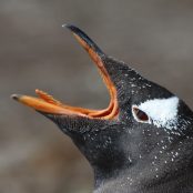
Photo: Gentoo penguins – Simon Pinder


↻ Back to News

ADDRESS:

The Observatory,

Dobies Business Park,

Lillyhall, Workington,

Cumbria, CA14 4HX

Tel: 01946 814463

Registered in England and Wales No. 5587044

Registered Office: The Observatory, Dobies Business Park, Lillyhall, Workington, Cumbria, CA14 4HX

Designed by furness.media